https://cuilcaghlakelands.org/geosite/lough-navar-forest/
Lough Navar Forest is a magnificent site within the Geopark. Extending across 2,600 hectares of bog, heath, open water, native woodland, and coniferous forest, there’s plenty to explore within this spectacular forest. The forest is located approximately 7.5 miles / 12km from Derrygonnelly and is rich in natural and historical antiquities. It is also home to one of the most breathtaking views in the island of Ireland, over the Magho Cliffs. It is hardly surprising that this forest is a mecca for walkers, fishermen and outdoor enthusiasts.
Lough Navar Forest along with Carrigan, Big Dog, Conagher and Ballintempo forests in west Fermanagh combine to form the largest continuous tract of forest in Northern Ireland covering over 8,500 hectares.
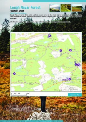
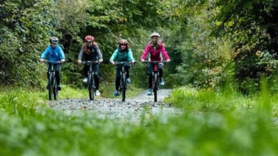
Facilities: car parking, interpretation, picnic area, 7 miles / 11km of scenic drive, viewpoints and four walking trails.
Lough Navar Forest
Carrick Lough Viewpoint is located at the entrance to Lough Navar Forest. A short walk from the carpark takes you through open forest to a viewing area from which Carrick Lough can be seen. Also visible from here are the remains of an ancient Crannog, which can be described as an artificially made small island farmstead.
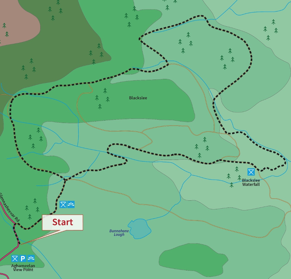
Aghameelan Viewpoint provides picturesque views over much of the County Fermanagh countryside and beyond into County Cavan. A patchwork of bog, heath, limestone grasslands and open water are clearly visible. Knockmore Cliff, which is comprised of carboniferous limestone, is a dominant feature of the landscape to the south. Evidence of Ireland’s glacial past is also clearly visible in the many drumlin hills dotted around the surrounding countryside.
This walk begins from the Aghameelan Viewpoint with the initial part of the walk taking you along forest tracks, deep into the forest through areas of mature planted conifers on the higher ground to areas populated by willow and aspen on the lower slopes. In areas where the forest is less dense, dappled light filters through giving rise to delicate woodland plants such as wood sorrel, wild garlic, and bluebells.
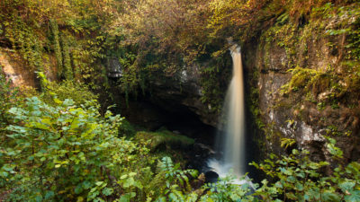
A series of linked forest tracks and paths zigzag through this forested area, however your path finally veers left. Contouring around a river bank the path leads through deep forest passing the ‘boulder field’ an area of huge sandstone boulders left behind as the ice sheets melted at the end of the last Ice Age over 13,000 years ago. Continuing uphill the path approaches Blackslee Waterfall, where water cascades over a 20m cliff before continuing its journey down an undercut rocky gorge. The gorge is carved from sandstones and mudstones, crosscut by a more resistant rock called dolerite, before flowing into Lower Lough Erne. Depending on the water levels at the time, this beautiful natural feature can range from a mere trickle to a raging torrent. The path continues its gradual climb uphill before adjoining the forest track, the final stretch of the path takes in capitulating stretches through corridors of forest which open to provide fine views over the neighbouring countryside.
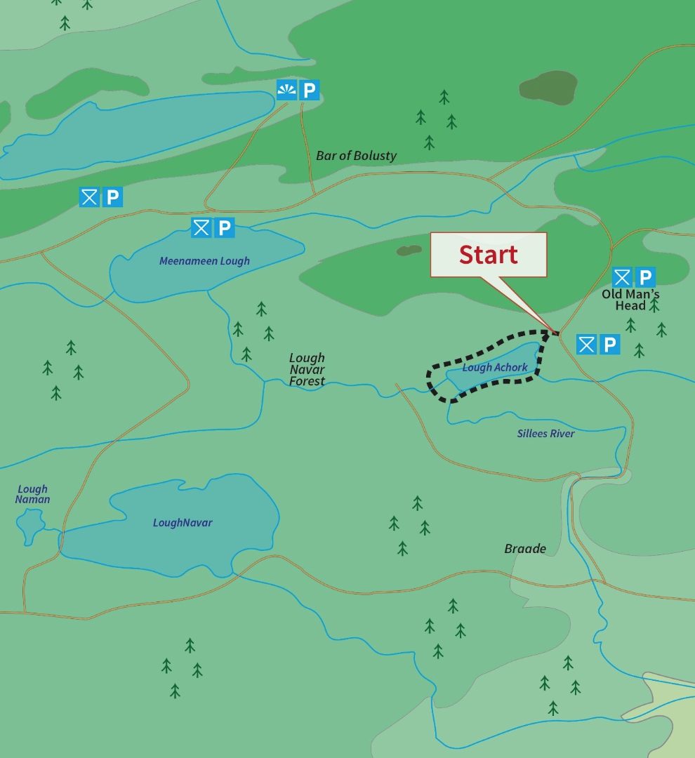
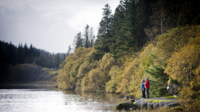
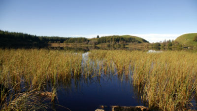
A path has been provided which circles this pleasant lake and offers views across the lake and its surrounding rugged hills. Lough Achork is the source of the Sillees River which runs through the nearby Correl Glen to eventually join Lough Erne near Enniskillen. The sheltered location of the lake and fringing woodland with its abundance of food make the area a popular haven for birds, otters, ducks, swans, foxes, deer, hares which can often be spotted feeding, nesting, or rearing their young in the area all year round.
Lough Achork is open to anglers with fishing permits and are well populated with good stocks of brown trout.
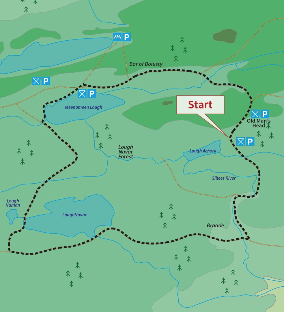
Trail 3 – Lakes Walk
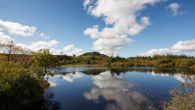
The initial part of this walk is along the scenic drive past Old Man’s Head; a sandstone scarp which resembles the profile of an elderly gentleman. The walk then skirts the western shoreline of Lough Meenameen before leaving the shoreline and disappearing deep into the heart of the forest leading to a junction where the obvious path will take you through deep corridors of planted Sitka spruce and lodge pole pine. Through the trees in the distance, you may glimpse Lough Navar and on the opposite side of the track is Lough Naman, a raised bog lake. This area is designated an Area of Special Scientific Interest (ASSI) and is home to a number of interesting species of plants including bog cotton, sedges and the tiny carnivorous plant, sundew. After passing Lough Navar and Lough Naman the walk leads you along the forest track before re-joining the scenic drive to begin its gradual but steady climb to Lough Achork. As you leave the forest track you will cross the Sillees River where a brief detour branching off to the Lough Achork shoreline offers fine views of the lake and surrounding area.
Lough Meenameen and Lough Achork are open to anglers with fishing permits and are well populated with good stocks of brown trout.
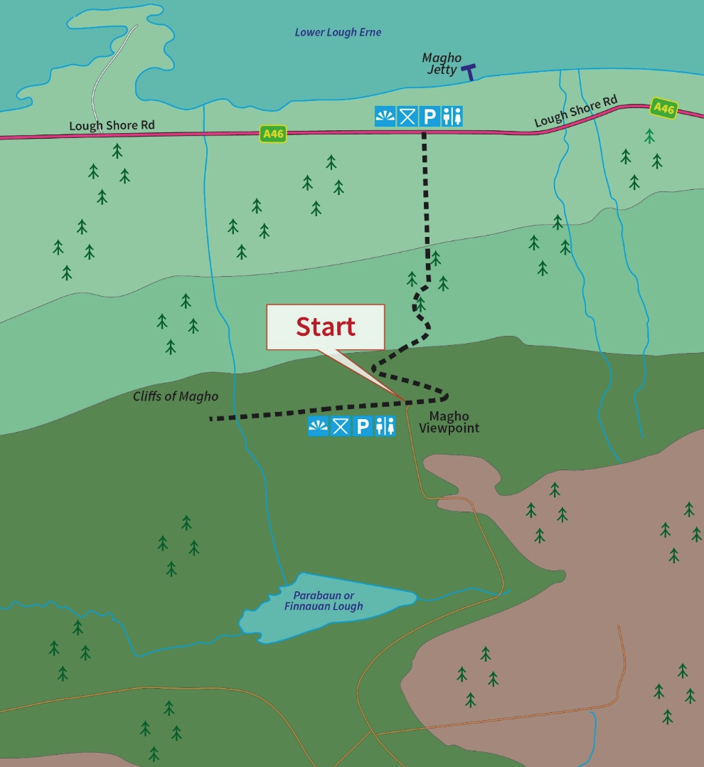
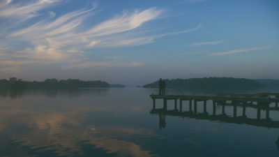
Magho Cliffs are a 5.5 miles long limestone escarpment dominating the southern shore and skyline of Lower Lough Erne on the northern edge of Lough Navar Forest.
For the initial part of the walk take the path leading to the left as it will take you across the top of Magho Cliffs offering great panoramic views of the surrounding area. At a height of 300m, the viewpoint offers a bird’s eye view across Lower Lough Erne, far into counties Fermanagh, Sligo, Tyrone, and Donegal and even as far as the Wild Atlantic Way. At the end of this path take a moment to rest on the bench provided and soak in the tranquil atmosphere. The cliffs are an Area of Special Scientific Interest as they support an exceptional range of habitats. The abundance of wildlife is very evident, keep an eye out for the array of butterflies and birds feeding in the area. To continue the walk, return back along the cliff top path and follow the black route way markers which will bring you down the cliff twisting and winding its way through the woodland with patches of open area providing great glimpses of the cliff escarpment.
You also have the option of parking in the carpark on the Lough Shore Road (toilets are available here) and doing this walk the opposite way around.
The ancient Crannog seen from Carrick Lough Viewpoint is described as an artificially made small island farmstead. The name “Crannog” derives from the Irish Crann (a tree), probably because the foundations of the island would have been a network of tree trunks. It dates back to the Late Bronze Age and Early Christian Times. It may also have been used for protection against enemy tribes or wild animals.
The Old Man’s Head: a strange rock which resembles the profile of an elderly gentleman is actually on an outcrop of sandstone known as Glenade Sandstone that has weathered into this shape over thousands of years by wind and rain. Here the flora changes to upland plants including varieties of speedwell, aquilegia, heather, and scabious. The roadside verges and welcoming flowers attract butterflies such as red admiral, speckled wood and peacock whose gentle and soft flight provides a refreshing amusement in this otherwise still landscape.
The Sillees River meaning “the sally kesh river” is often referred to as the ‘Silly River’ as it winds and twists through the countryside before entering the River Erne near Enniskillen.
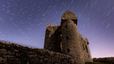
Church Hill, Fermanagh
Nestled on the shores of Lower Lough Erne, are the impressive remains of a forti...
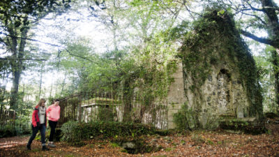
Doagh Glebe, Fermanagh
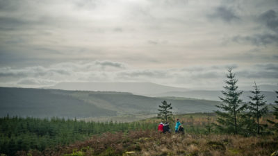
Carrigan Forest is the gateway between two significant expanses of upland forest...
Blaney, Fermanagh
The forest extends over 250 hectares and is a delightful mixture of both native ...
Drumshane, Fermanagh
A 520 hectare mixed broadleaved and coniferous lowland forest located on the sho...
Scribbagh, Fermanagh
Big Dog Forest, cloaked largely with conifers, dotted with open stretches of upl...
Enniskillen, Fermanagh
A stunning site, giving visitors views of one of the largest and best preserved ...
Leggs, Fermanagh
An outstanding site, both for its peninsular position on the shores of Lower Lo...
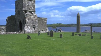
Enniskillen, Fermanagh
The early Christian Monastery and round tower at Devenish is one of Ireland’s mo...
Distances are from Lough Navar Forest
This is a cooperation project between Fermanagh and Omagh District Council and Cavan County Council.
This element of the project is part funded under Priority 6 (LEADER) of the Northern Ireland Rural Development Programme 2014-2020 by the Department of Agriculture, Environment and Rural Affairs and the European Union. We would like to acknowledge the assistance of County Cavan Local Community Development Committee (LCDC), Cavan County Council, Breffni Integrated CLG, Department of Rural and Community Development, the EU and EAFRD in part-funding this project. Funded by the Irish Government Under the Leader Programme 2014-2020.